FDA-E.1672-2015
Parts
Object number
FDA-E.1672-2015
Identification
Title
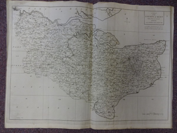
A Map of the County of Kent
Title Type
assigned by artist
Description
Content (place)
Kent
Content (note)
Map of Kent, with scale
Dimensions
height (actual size): 520mm
width (actual size): 725mm
width (actual size): 725mm
Inscription
Lettered 'A Map / of the / County of Kent / Taken from an Actual / Survey / As an Index to the Large One', 'NB This Map is divided into Twenty five Squares, / each Squre containing one sheet of the Large one, / each sheet is to be found by the Number of the Square'
Lettering on map
Lettering on map
Physical description
Plate mark
Production
Person
Kitchin, Thomas, 1719 - 1784 (Engraver)
Date
18th century


